

Faites connaître cet article à vos amis:
Rand McNally Easy to Read State Map California
Rand McNally
Commandé depuis un entrepôt distant
Nos clients disent :

Rand McNally Easy to Read State Map California
Rand McNally
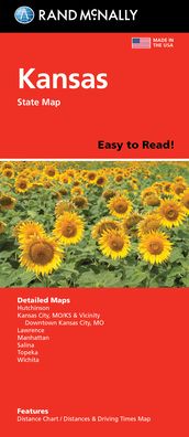
Rand McNally's Easy To Read State Folded Map is a must-have for anyone traveling in and around California, offering unbeatable accuracy and reliability at a great price. Our trusted cartography shows all Interstate, U. S., state, and county highways, along with clearly indicated parks, points of interest, airports, county boundaries, and streets. The easy-to-use legend and detailed index make for quick and easy location of destinations. You'll see why Rand McNally folded maps have been the trusted standard for years. - Regularly updated, full-color maps. - 40% larger map with a bigger type size than the Rand McNally Folded Map. - Clearly labeled Interstate, U. S., state, and county highways. - Indications of parks, points of interest, airports, county boundaries, and more. - Mileage and driving times map. - Detailed index. - Convenient folded size. Coverage Area Detailed maps of: Bakersfield, Fresno, Joshua Tree National Park, Kings Canyon Natl Park & Sequoia Natl Park, Lake Tahoe Region, Lancaster/Palmdale, Los Angeles, Modesto, Monterey/Salinas, Oceanside, Oxnard/Ventura, Palm Springs, Sacramento, San Diego.
| Médias | Livres Sewn Spine Book (Livre avec couverture souple et dos cousu de haute qualité) |
| Validé | 7 avril 2023 |
| ISBN13 | 9780528027314 |
| Éditeurs | Rand McNally |
| Genre | Maps & Guides |
| Dimensions | 90 g |
| Langue et grammaire | English |
Plus par Rand McNally


D'autres ont aussi acheté
![Cover for Preben Hansen · Turen Går Til: Turen går til Californien & Vestlige USA (Sewn Spine Book) [5e édition] (2021)](https://imusic.b-cdn.net/images/item/original/578/9788740063578.jpg?preben-hansen-2021-turen-gaar-til-turen-gaar-til-californien-vestlige-usa-sewn-spine-book&class=scaled&v=1623395637)
![Cover for Knud Romer · Den som blinker er bange for døden (Sewn Spine Book) [5e édition] (2016)](https://imusic.b-cdn.net/images/item/original/573/9788711569573.jpg?knud-romer-2016-den-som-blinker-er-bange-for-doeden-sewn-spine-book&class=scaled&v=1480182943)
![Cover for Kerstin Ekman · Ulvespring (Bound Book) [1er édition] (2022)](https://imusic.b-cdn.net/images/item/original/272/9788702347272.jpg?kerstin-ekman-2022-ulvespring-bound-book&class=scaled&v=1661970721)
![Cover for Jens Andersen · Kongeord (Bound Book) [1er édition] (2024)](https://imusic.b-cdn.net/images/item/original/776/9788740092776.jpg?jens-andersen-2024-kongeord-bound-book&class=scaled&v=1706260512)


Voir tous les Rand McNally ( par ex. Paperback Book , Map , Hardcover Book , Book et Spiral Book )