

Faites connaître cet article à vos amis:
Rand McNally Folded Map: Central United States Map
Rand McNally
Commandé depuis un entrepôt distant
Nos clients disent :

Rand McNally Folded Map: Central United States Map
Rand McNally
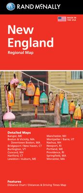
Rand McNally's folded map featuring the Central United States is a must-have for anyone traveling in and around this part of the country, offering unbeatable accuracy and reliability at a great price. Our trusted cartography shows all Interstate, state, and county highways, along with clearly indicated points of interest, airports, county boundaries, and more. You'll see why Rand McNally folded maps have been the trusted standard for years. -Regularly updated, full-color maps. -Clearly labeled Interstate, U. S., state, and county highways. -Detail maps of major cities, a mileage chart, and a Mileages & Driving Times Map. - Indications of parks, points of interest, airports, county boundaries, and more. -Easy-to-use legend. -Detailed index. Coverage Area: Arkansas, Illinois, Iowa, Kansas, Louisiana, Minnesota, Mississippi, Missouri, Nebraska, North Dakota, Oklahoma, South Dakota, Texas, and Wisconsin. Product Details: Measures 9.5 x 4.125 and folds out to 40 x 28. Scale: 1 = 43 miles.
| Médias | Livres Map (Cartes terrestres ou marines) |
| Validé | 6 août 2021 |
| ISBN13 | 9780528024597 |
| Éditeurs | Rand McNally |
| Dimensions | 102 × 236 × 8 mm · 250 g (Poids (estimé)) |
| Langue et grammaire | English |
Plus par Rand McNally


D'autres ont aussi acheté
![Cover for Preben Hansen · Turen Går Til: Turen går til Californien & Vestlige USA (Sewn Spine Book) [5e édition] (2021)](https://imusic.b-cdn.net/images/item/original/578/9788740063578.jpg?preben-hansen-2021-turen-gaar-til-turen-gaar-til-californien-vestlige-usa-sewn-spine-book&class=scaled&v=1623395637)
![Cover for Knud Romer · Den som blinker er bange for døden (Sewn Spine Book) [5e édition] (2016)](https://imusic.b-cdn.net/images/item/original/573/9788711569573.jpg?knud-romer-2016-den-som-blinker-er-bange-for-doeden-sewn-spine-book&class=scaled&v=1480182943)
![Cover for Kerstin Ekman · Ulvespring (Bound Book) [1er édition] (2022)](https://imusic.b-cdn.net/images/item/original/272/9788702347272.jpg?kerstin-ekman-2022-ulvespring-bound-book&class=scaled&v=1661970721)
![Cover for Jens Andersen · Kongeord (Bound Book) [1er édition] (2024)](https://imusic.b-cdn.net/images/item/original/776/9788740092776.jpg?jens-andersen-2024-kongeord-bound-book&class=scaled&v=1706260512)


Voir tous les Rand McNally ( par ex. Paperback Book , Map , Hardcover Book , Book et Spiral Book )